

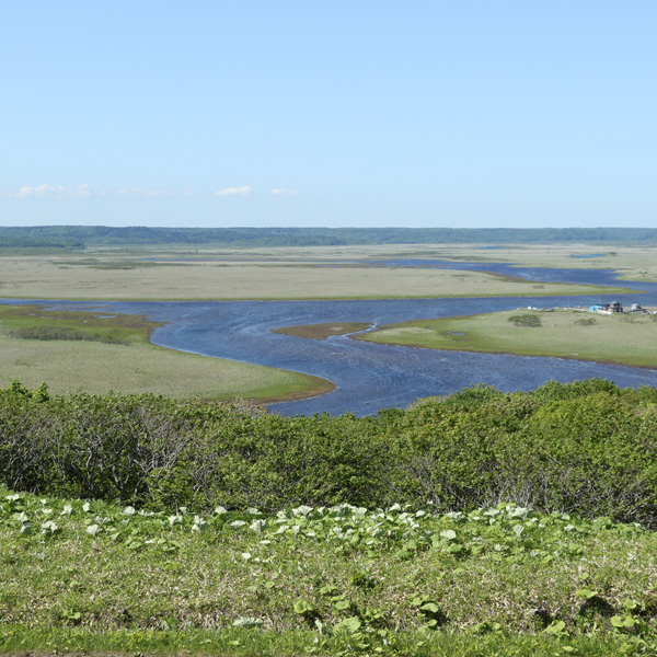
Biwase Observatory
Located on a hill south of Kiritappu Wetland, you can enjoy a 360-degree view.
Looking ahead, a large panorama of the Biwase River meandering through the vast Kiritappu Wetland unfolds, and looking back, the rough landscape of the Pacific Ocean awaits, and it is also rated as an international tourist.
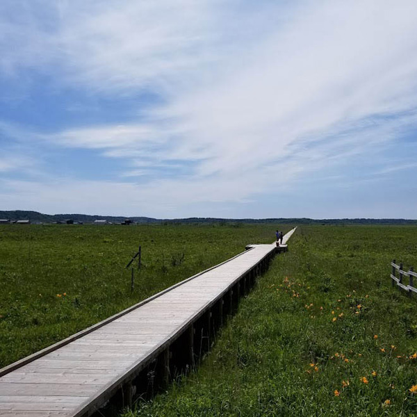
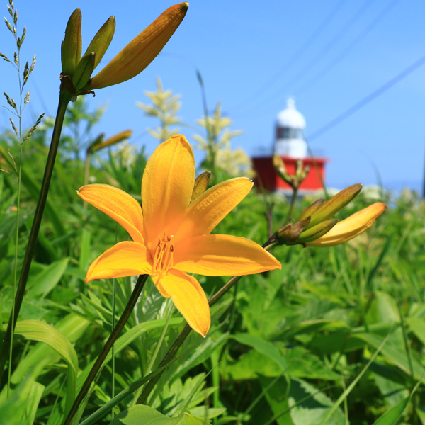
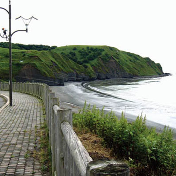
Biwase wooden path
This is one of the places where you can feel the Kiritappu Wetland most closely.
The 500-meter one-way wooden path is a walking course while observing the plants unique to the marsh.
The deck of the back is a spot overlooking the waterside, and if you are lucky, you can meet wild animals such as Japanese cranes and sika deer.
The scenery of the marsh that changes its appearance depending on the season will be a wonderful experience whenever you visit.
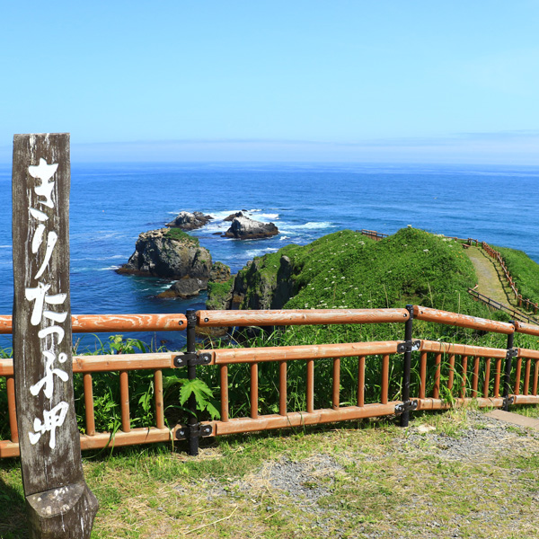
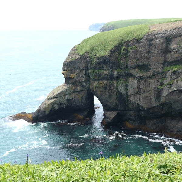
Cape Kiritafu(Tobutsu Misaki)
Cape Kiritafu is officially called Tobutsu Misaki.
It is also called Tokkari Cape because you can see Tokkari (seals).
Located on the eastern side of the table-shaped Kiritappu Peninsula at an altitude of 40 to 60 meters, it protrudes into the rough waves of the Pacific Ocean, and there are observatories and campgrounds in the vicinity, making it ideal as a plaza for Ikoi.
From the observatory, you can see the seal rocks, Ponporoto, Moraito's cliffs, and the coastline over Hamanaka Bay, 3 km away.
In addition, there is a legend called "Tokkari Cape no Uta" at Cape Kiritafu, and the reason why seals can be seen here is still being told today.
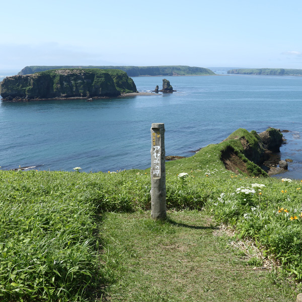
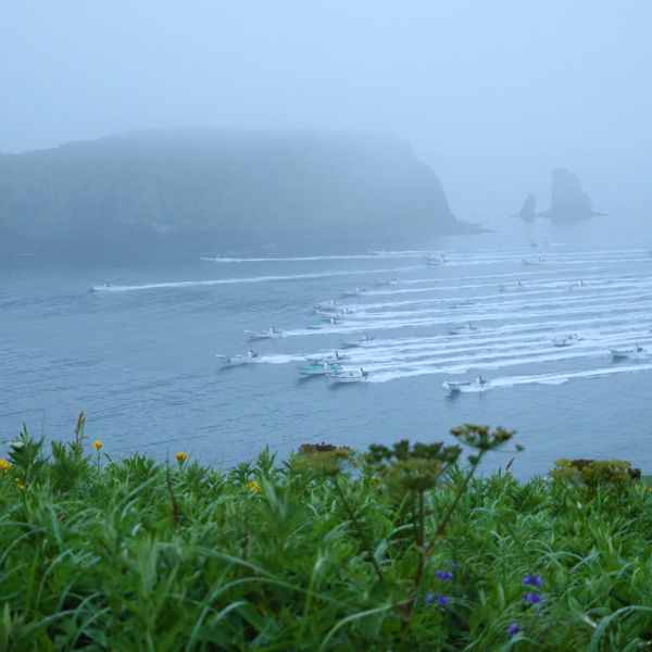
Azechi Cape
The eastern end of the Kiritappu Peninsula is "Kiritappu Cape". And at the west end is here "Azechi Cape".
Cape Azechi is a cape that juts out into Biwase Bay, overlooking Kojima, Gome Island, and Kenbokki Island, and overlooking the coastline of Biwase Bay and Hamanaka Bay, and the midsummer sunset is wonderful.
The bird "Etopirica" from Hamanaka Town nests on a small island seen from the tip of Azechi Cape. In the past, many tufted puffin nested on Gome Island as seen from Cape Kiritafu. Hamanaka Town has many small islands and rocks that are sacred places for such seabirds, so many seabirds inhabit.
Also, at Azechi Cape, the appearance of fishing all at once on a sunny day during the Kombumori fishing season is spectacular, and the roaring sound of competing with each other makes you feel the excitement of a man in the sea.
Cape Tear
When you visit Cape Tear, you can remember the love story between Amimoto's daughter and the young people, which is the story of an old man.
It is said that the crying figure of a maiden in love with a young man caught in the stormy sea became a rock in this place, and it is said that the maiden's sobbing can be heard on stormy nights.
Therefore, it is a land that is also known as "Tears of the Maiden".
The profile of the maiden carved on the cliffs of several tens of meters invites travel.
Urayakotan Parking Park
It is located on the way from Hamanaka Town to Nemuro City (North Pacific Seaside Line).
From here, you can see the undulating scenery of the coast of Urayakotan and the coastline.
In addition, the North Pacific Seaside Line is a road that runs along the coastline from Kushiro Town Konbumori to Nemuro City, making it ideal as a drive course.
Dairy Observatory
From the dairy observatory on the hill along National Highway 44, you can see the beautiful green ranch scenery and the distant Shiretoko mountain range.
A gentle slope continues to flow, and a herd of cows grazes and depicts the image of a large dairy kingdom.
